
Information
What Information is Included
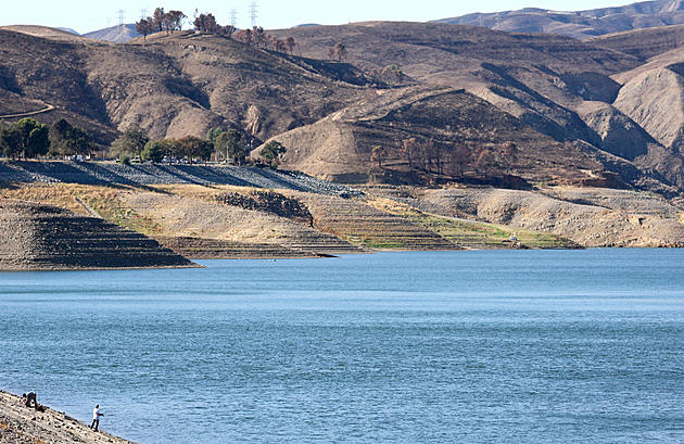
The California Water Data from the United States Geological Survey (USGS) includes data about the state’s water quality, usage, and drought conditions. This data collection encompasses mainly historical records, offering a comprehensive picture of the state of the water and the management initiatives in place. The data is arranged geographically, paying particular attention to California’s numerous watersheds, basins, and aquifers. Measurements of surface and groundwater levels, analyses of domestic, industrial, and agricultural water usage, and evaluations of water quality, including pollution levels and contaminant occurrences, are important data points. This comprehensive dataset serves as a starting point for understanding the dynamics of water scarcity, the impact of usage patterns on resources, and the ongoing challenges of maintaining water quality in the face of environmental and human pressures.

What Information is Illuminated
From our extensive collection of datasets, our attention turns specifically to water data. This encompasses a wide range of water-related information, such as drought indicators, water use, and quality assessments. The data is comprehensively mapped across California, detailed down to counties and specific locations within those areas, facilitating a deeper understanding of water resources and challenges. This allows for an in-depth exploration of how various regions may be differently affected by water-related issues. Such data proves invaluable for researchers, water resource managers, policymakers, and the public interested in grasping the dynamics of water availability, usage patterns, and quality concerns. It is crucial for analyzing the complexities of water management in California, a state with unique water needs and challenges due to its diverse climate and water demands.
Gaps
What Information Cannot be Revealed
Given that less severe water-related issues may not be systematically recorded, the data primarily consists of documented incidents, which could lead to potential gaps in the dataset. Inaccuracies may arise from data entry errors, inconsistencies in categorizing water events, or varied standards of reporting, all of which can introduce biases. The methodology for reporting water data can differ significantly across different geographic regions. These regions may lack access to detailed socioeconomic data critical for analyzing the broader impacts of water scarcity, quality issues, and community vulnerabilities to these challenges. Furthermore, the dataset might not capture the full context of each water-related event, including the extent of damages, the affected populations, and subsequent response efforts.


Sources
How the Data was Generated
Drought and water usage data are compiled from a variety of sources, including federal and state environmental agencies, water resource management bodies, local monitoring stations, and community reports. USGS centralizes data collection to provide a unified overview of water conditions across the state at the county level. To ensure the accuracy and reliability of this data, the USGS implements detailed quality control procedures, including cross-verification and examining any discrepancies or inconsistencies found within the data. This approach to data gathering and validation encourages precise and thorough insights into drought conditions and water usage patterns, offering a crucial tool for water resource management and conservation efforts.
The project leverages diverse datasets including the CDC’s Environmental Justice Index for insights on water scarcity and health, NOAA’s climate projections for future drought impacts in California, the California Department of Water Resources for water rights and usage, CalEnviroScreen for mapping pollution and vulnerability, the SAFER Dashboard for water system quality in at-risk communities, and USGS Water Use Data for historical water usage patterns, together providing a comprehensive overview of water scarcity, quality, and environmental justice challenges.
Biases
Ideological Effects
The public’s understanding of water scarcity and environmental justice issues can be shaped by how data sources like the Environmental Justice Index and NOAA’s drought projections highlight certain aspects of water access and quality, potentially emphasizing certain narratives over others. Gaps in decision-making can emerge from the lack of comprehensive coverage in these datasets, particularly affecting underrepresented or marginalized communities. The focus on socioeconomic factors by datasets such as the EJI might suggest that these are the predominant determinants of vulnerability, overshadowing other types of susceptibilities. Also, the process of gathering data for these sources may not fully engage communities in a way that allows them to influence the discussion and priorities surrounding water scarcity and environmental justice, potentially overlooking the insights and needs of those most affected.
EJI v. Water Quality Discussion
To ensure that the correlation (or lack thereof) from the narrative data visualization mapping water system quality versus environmental justice was indeed correctly mapped, a data sanity check was also created. On this page, one can confirm that water quality points were mapped to federal tracts correctly, and likewise with the EJI points (which had a census tract already included in the data). The final visualization has the corresponding tract labeled, so we know each point is corresponding to just one tract.
The three data sources used were:
The data joining process was:
- For each water quality point, find which tract that point exists within using census tract data
- EJI data is already in terms of tracts
- Take the average of water quality per tract (often there is only 1 water quality point per tract, or none at all)
- Compare the average water quality per tract to the EJI of that tract, for all tracts that have both defined
After confirming data joining was successful, it’s more likely an issue of dataset choice that led to the lack of correlation. The EJI is calculated using a wide variety of factors, and the water quality data may not necessarily be affected in the same way other environmental factors are related to social justice issues. A dataset looking at other ways in which water may be affected, such as the availability instead of the quality as we looked at in the visualization following this one in the narrative, may provide a better correlation.